Final Exam for GIS 303
Please choose two of the following questions to answer in essay format. Essays are due no later than noon on Tuesday, May 29. Please submit them in writing to my mailbox in the administration building, or by e-mail (please Cc it to both griots@hotmail.com and geo300@skittlebug.net)
1. "It is the issue of communication that holds the central role in cartographic design. To ask "what is a good map?" is to ask how well it communicates with its audience." What are the most important considerations in designing a map to communicate information? How are maps made on computers different from traditional paper maps? Include a discussion of the purpose of the map, who will read the map, the limits of scale, and elements found on virtually all maps.
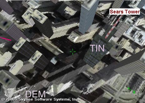
2. Each of the following images was generated in Terra Explorer. Notice that the 3-D feature of Sears Tower in Chicago rendered as a TIN also shows up in the aerial photograph draped on the DEM. Also compare the actual photograph taken from the scenic overlook at Skyline College with a similar image generated in TerraExplorer. Compare the way TINs and DEMs are stored in a computer database, and discuss the limitations of these models of virtual reality.
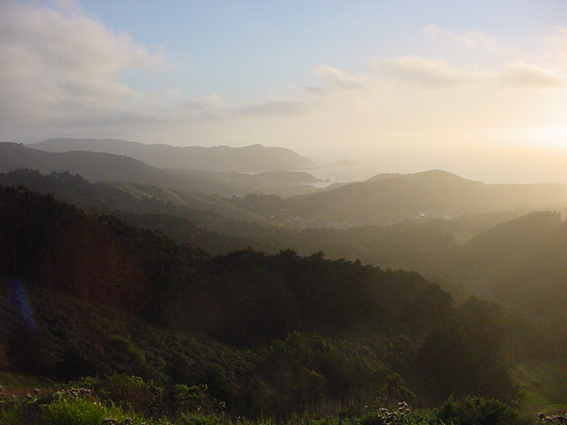
Photograph from Skyline College overlook.
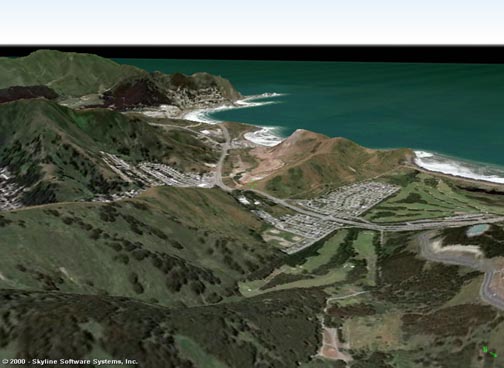
Terra Exploer rendered landscape looking from above the Skyline College scenic overlook.
3. Briefly explain how GPS works, what information it can provide, and the uses of GPS data in a GIS. How are GPS and GIS technologies merging?
4. Discuss how remote sensing images are acquired and their use in studying the natural hazards and geology of the earth's surface.
5. Serving maps on the internet means communicating with an audience which may have limited technical skills and cartographic knowledge. Discuss what you learned about constructing intuitive mapping websites. Please give examples of both user friendly and less accessible interactive web-based GIS systems.